

The plan was to hike up Sugarloaf Peak (11,051 feet/3,368 meters) and Mt. Baldy (11,068 feet/3,374 meters), two 11,000-foot mountains above the ski resort Alta in Utah’s Wasatch Mountains. I hadn’t climbed either. It was the end of June, and the road all the way into Albion Basin (the easiest/closest access point for these peaks) was closed until July 1, so I had to park at Alta and hike in from there. I hiked up the Upper Albion Meadows Trail (1.5 miles) to the Cecret Lake Interpretive Trail (.75 miles), which took me to pretty little Cecret Lake.

Looking back at the trailhead toward Mt. Superior. The trip report from my solo ascent of Mt. Superior is here.

Devils Castle is on the left, Sugarloaf is on the right.

A closer look at Devil’s Castle. I’ve climbed the large face behind and to the left of the largest tree in the photo three times via three different routes: Black Streak (III 5.10b), Horns of Satan (III 5.10b/c), Portable Darkness (III 5.9+).

Sugarloaf is the mountain on the left. Mt. Baldy is the mountain on the right.

Me at Cecret Lake. Devils Castle is in the background.
From there I followed a trail up to the saddle between Sugarloaf and Baldy and then on up to the Mt. Baldy summit.

A snow patch I climbed up below the Sugarloaf-Baldy saddle.
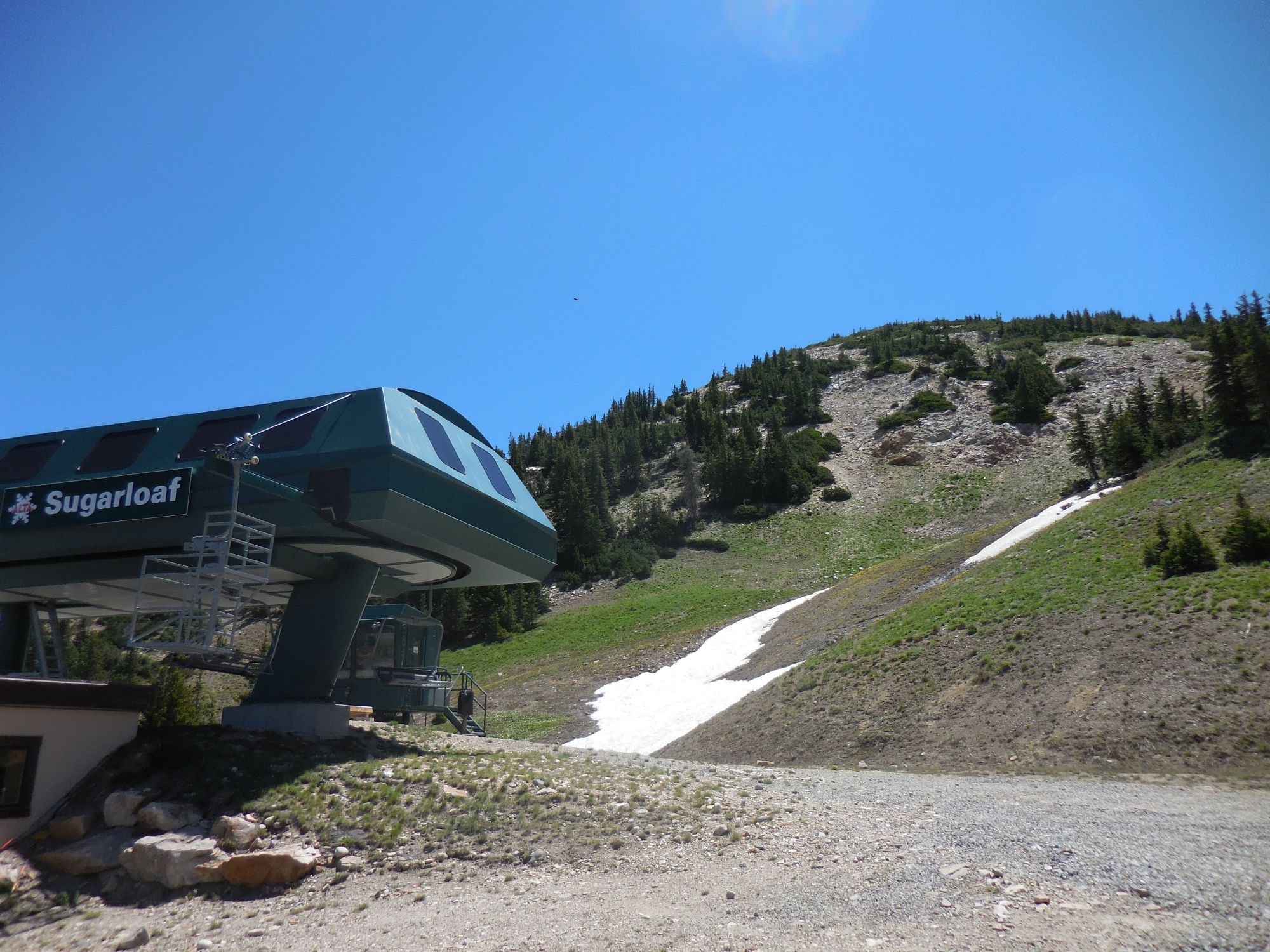
The top of Alta’s Sugarloaf lift at the Sugarloaf-Baldy saddle below Sugarloaf.

American Fork Twin Peaks (often just called Twin Peaks) from the hike up Sugarloaf. The peak to the right of Twin Peaks is Hidden Peak, which is the top one of Snowbird’s trams.

Mt. Baldy and the Sugarloaf-Baldy saddle from partway up Sugarloaf

Nearing the top of Sugarloaf

Devil’s Castle from the top of Sugarloaf

Cecret Lake from the top of Sugarloaf

Twin Peaks, Hidden Peak (with the blue tram building), and Mt. Baldy from the top of Sugarloaf.

Mt. Timpanogos from the top of Sugarloaf. I’ve climbed Mt. Timpanogos twice. I wrote about one of the times here.
I then descended back to the saddle and then went up Mt. Baldy. The part right above the tram was steep at first, but it leveled out and was reasonable toward the top.

I can see why.

The route up Mt. Baldy from the Sugarloaf lift.

Looking down from partway up Mt. Baldy

Sugarloaf from Mt. Baldy

Nearing the top of Mt. Baldy

Hellgate, a popular rock climbing area near Alta

The top of Mt. Baldy with the peaks of the Cottonwood Divide behind

Looking back to Sugarloaf from the top of Mt. Baldy. Some of the high peaks of the Uinta Mountains can be seen on the horizon.

Mt. Timpanogos, Twin Peaks, and Hidden Peak from the top of Mt. Baldy

Little wildflowers and the Salt Lake Valley
When I was up there I looked toward Twin Peaks and thought what the heck, I might as well go climb those too, so I did. The trail descended off to the west toward Hidden Peak (where a huge new restaurant or something is being built) and then went up the ridge toward the Twin Peaks summit. The ridge narrowed and turned into this awesome class 3/4 scramble. It was so much fun. There were a few bolts there, which was odd. Apparently they are for guided parties. The rock turned from red quartzite to black rock and the angle got steeper, and I had the top all to myself.

The Hidden Peak tram and Twin Peaks

The ridge between Hidden Peak and Twin Peaks starting to narrow

The ridge narrowing even more

The steepest, most difficult, and most interesting part of the ridge

One of the bolts on the ridge

Looking down to Hidden Peak from near the top of the scrambling section

On the lower of the two summits of Twin Peaks

The summit of Twin Peaks

Mt. Timpanogos and Box Elder Peak (which I climbed a week or two earlier) from the summit of Twin Peaks
I hadn’t looked up any information about descending from Twin Peaks because I didn’t think I’d be up there, but it wasn’t too hard to figure out. I dropped down into the Snowbird area and followed dirt roads and trails down to Snowbird Village and the road at the bottom of Little Cottonwood Canyon. From there I hoofed it up the side of the road to my car at Alta.

Looking up at Twin Peaks after dropping down toward Snowbird. The skyline ridge is the one I climbed up to the summit.

The Cottonwood Divide

Looking out to the Salt Lake Valley

Snowbird Resort
All in all, it was a wonderful day in the mountains, and I’m now a few peaks closer to climbing all of the Wasatch 11,000ers.
Here are my times:
10:34 – Left the parking lot
11:06 – At Cecret Lake trailhead sign
11:23 – At Cecret Lake
12:10 – On top of Sugarloaf
12:32 – Left the top of Sugarloaf
12:43 – Back at the Sugarloaf/Baldy saddle
1:05 – On top of Baldy
1:19 – Left the top of Baldy
1:40 – On top of Hidden Peak
2:40 – On top of the lower of Twin Peak’s summits
2:50 – American Fork Twin Peaks summit
2:57 – Left the top
5:08 – Back on the Little Cottonwood Canyon road
5:36 – Back at my car

A very rough map of my route