


The purpose for this trip was threefold: (1) to go on my first “microadventure,” (2) to climb and spend the night on top of a nearby mountain I was unfamiliar with, and (3) see how light I can get my overnight backpacking kit down to.
Regarding the first purpose, “microadventure” is a phrase coined and an idea championed by adventurer Alastair Humphreys. According to Humphreys, “A microadventure is an adventure that is short, simple, local, cheap – yet still fun, exciting, challenging, refreshing and rewarding.” This concept appealed to me. My schedule is pretty flexible, and I can usually find the time to go on whatever adventure I want, but I thought it would be a fun experiment to see what kind of adventure I could have in a much shorter period of time. More specifically, I’d go on a 5 to 9 microadventure, meaning that I’d start at 5 pm and finish at 9 am. It’s the kind of thing you could fit in during the week even if you had a 9-to-5 job.
The second purpose was to climb Lewis Peak (8,031 feet/2,448 meters). This is a mountain directly above my newly adopted home of Ogden, Utah, and I see it every day. I’d already climbed the mountains to the north and south of it, so it was the next logical one to fall. I’d hike it via the South Skyline Trail, one of the main routes up the mountain.
The third purpose was to test out a new ultralight backpacking setup. Ultralight backpacking is generally referred to as backpacking with a base pack weight of 10 pounds or 5 kilos or less. (Base pack weight is the weight of a pack minus food and water.) Last year I hiked a handful of long trails, and my pack got lighter on each one. For the last one, Mt. Rainier’s 93-mile Wonderland Trail, I finally broke into the sub-10-pound realm. Since then I’d been doing a lot of thinking about how to lighten my load without buying new gear, and my strategy for this trip was to test out some of the things I’d thought about, namely (1) taking very little and (2) replacing my larger and heavier pack (the 58-liter Osprey Exos 58) with a much smaller pack (REI Flash 22).
After packing everything I needed into the pack, I weighed it and saw that without food and water it weighed 7 pounds on the nose. That’s for a backpack, sleeping bag, shelter, and sleeping pad, among a bunch of other things (see full detailed packing list below). Some people go camping with tents that weight 7 pounds by themselves!
I left the house at 5:15 pm and was on the trail by 5:45. Lewis Peak is almost like a plateau; it’s got steep sides but a relatively flat top. This meant that the two miles or so of the trail were steep as it switchbacked up the side of the mountain, but then it leveled off. Instead of describing how wonderful the view and terrain were, I’ll say to just look at the pictures below.
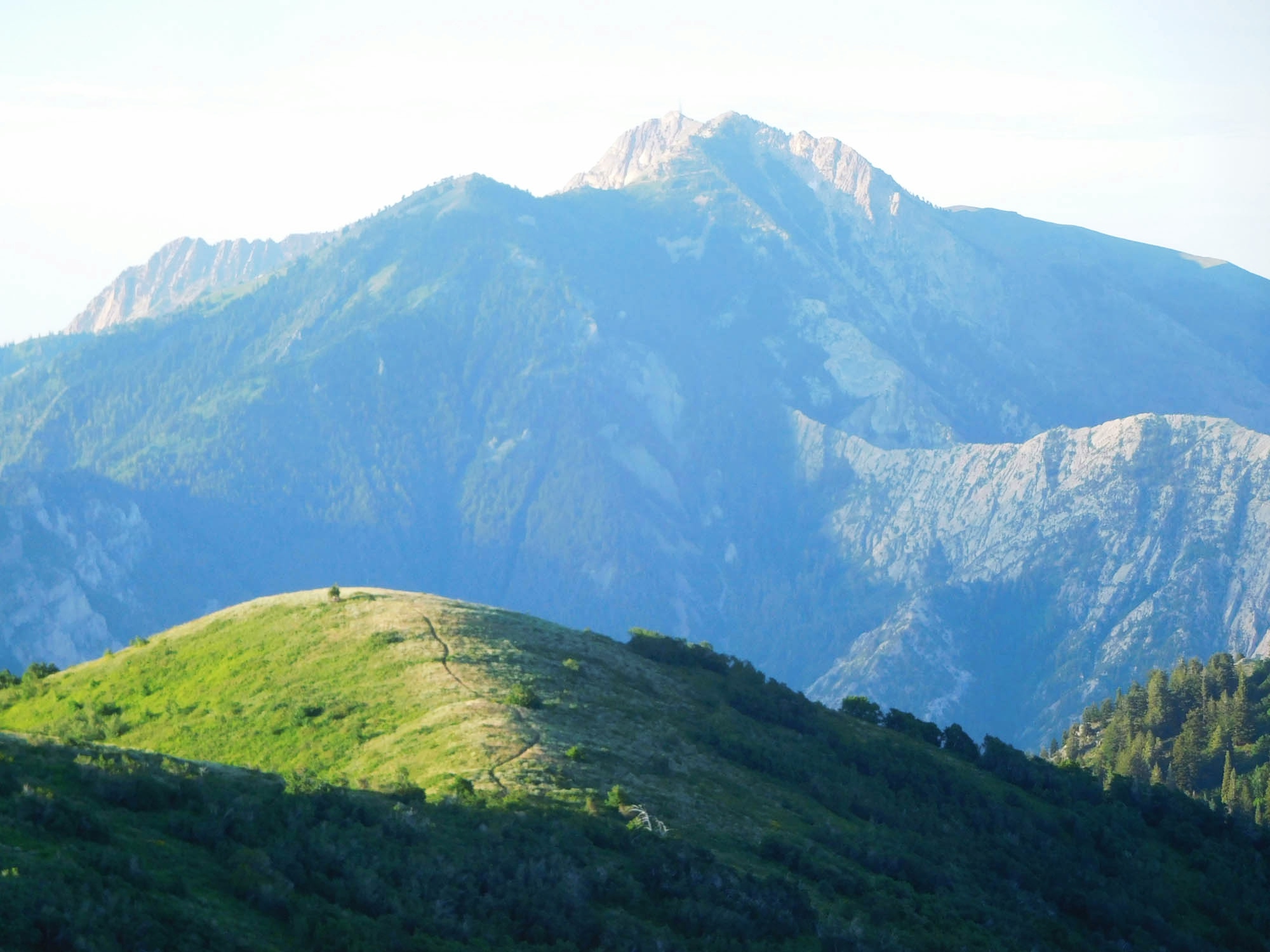
One weird thing about Lewis Peak is that it’s not actually the highest point on the mountain. Lewis Peak is a bump at 8,031 feet along the summit ridge of the mountain, but it’s seen by most people as the true summit because it overlooks the city of Ogden. The actual highpoint is an officially unnamed Point 8,136 that I’ve seen referred to as “Eyrie Peak.” I made it to the top of Eyrie Peak (~3 miles) in an hour and a half, ate half of my sandwich, and then covered the remaining 2.5 miles to the top of Lewis Peak, reaching the point at about 8:10 pm. There was no one on top, and I hadn’t seen anyone after about the first ten minutes on the trail. As I’d suspected, there were a couple of small campsites near the top, and I picked one that had a particularly good view of the Great Salt Lake and the most prominent mountain of this part of the Wasatch Range, Ben Lomond.
It didn’t take long to get my camp set up. I laid out my polycro ground sheet, inflated my sleeping pad, unpacked my sleeping bag, and whipped out my homemade bug bivy. After polishing off most of the rest of my food, I sat and watched the amazing sunset over the Great Salt Lake before crawling into my sleeping bag for the night.
The air temperature was a bit warm (I’m guessing ~55 degrees) for my sleeping bag, but I slept well enough for about 8 hours. I woke at about 6:25 am, was on the trail at 6:50, back at the trailhead at 8:40, and back at home shortly after 9.
So how’d it go? Pretty much perfectly. It was a flawless microadventure. I climbed both Lewis Peak and “Eyrie Peak.” My 7-pound kit worked perfectly, and I’ll be able to shave off even more weight next time. Now to start planning the next microadventure…

The food I took with me. Potato chips. Pepperoni and cheese bagel. Coconut-flavored almonds. 4 protein bars. Sour Patch Kids. Roast beef sandwich.

Looking east into Ogden Valley

Looking south. Pineview Reservoir is down in Ogden Valley below

Pineview Reservoir

Looking back north toward Ben Lomond

On the “plateau” up at the top. Eyrie Peak (the highpoint of the mountain) is just right of center. Lewis Peak is the rounded knob on the far right. That’s where I camped.

Beautiful

My pack

Eyrie Peak selfie

Wildflowers

My camp. I tied a piece of cord between the bug bivy and the trekking poles to keep the netting off of my face.

Getting closer to sunset

The setting sun turned the Great Salt Lake into lava

Sunset

Back on the trail the next morning
Looking south to Mt. Ogden in the morning

Wildflowers and Mt. Ogden

Nice and green

Looking ahead to Ben Lomond

2.5 miles to the trailhead and 3 miles to Lewis Peak

A male Gambel’s quail (?) flirting with me

Most of the things I took with me. The items covered with green boxes are what I’ll probably leave behind next time.
The Gear
Here’s everything in the photo above, row by row, starting from the top left (the Amazon links are affiliate links):
TOP ROW
- ~3.5 liters of water – I only needed about 2.5 liters. There is no water anywhere on the mountain, so I had to take it all with me.
SECOND ROW
- Homemade mosquito bivy – Weighs about 7 ounces including its Ziploc freezer bag “stuff sack.”
- Outdoor Research Helium Jacket – I love this jacket. (Amazon)
- Buff knockoff – It wasn’t cold enough for me to need to wear it.
- Driver’s license and credit card – Should have left them in the glove compartment.
- Two lengths of thin cord – I used one to keep the bug bivy’s netting off of my face. Didn’t need the other.
- Eye drops
- USB-reachargeable headlamp – Didn’t really need it, but I like having a headlamp around, so I’ll probably take it again next time.
- Sleep mask and ear plugs – I’m a light sleeper.
THIRD ROW
- Polycro ground sheet in a snack-sized Ziploc bag
- Down vest – It was too warm to need this.
- Toilet paper in Ziploc bag – Didn’t use it, but good to have
- USB cable – Didn’t use
- Selfie stick – Didn’t use
- USB battery pack – Didn’t use
FOURTH ROW
- Therm-a-Rest NeoAir XLite Sleeping Pad (size regular) – Amazon link
- Trekking poles
FIFTH ROW
- REI Flash 22 backpack with MLD hip belt pockets
- Down sleeping bag I bought in Nepal for $75 (with compression stuff sack)
- Running visor
EVERYTHING ELSE (NOT PICTURED)
These are the things I wore and had in my pockets:
- Lip balm
- Sunglasses
- Camera
- Car key
- Headphones
- Phone
- Hiking pants
- T-shirt
- Underwear
- La Sportiva Wildcat trailrunning shoes – Amazon link
- Very thin merino wool socks